
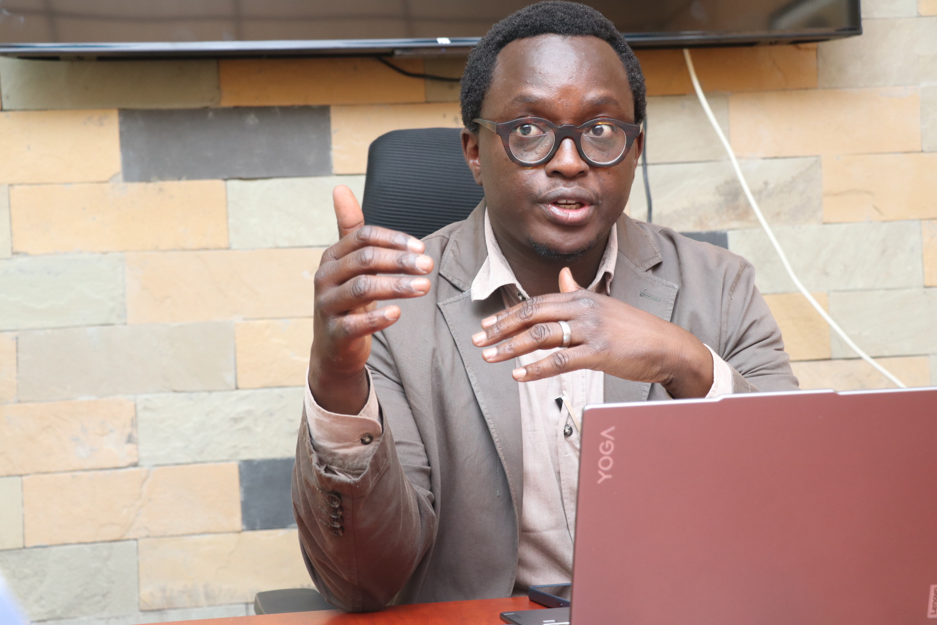
 Architect Mumo Musuva, the vice-chairperson of the Nairobi Rivers Commission, on April 17, 2025. Photo/ Leah Mukangai.
The Nairobi River once teemed with life. But it is today the dirtiest waterway in Kenya, with nearly half its volume made up of raw sewage and industrial effluent. It is linked to disease outbreaks and deaths in the city and downstream. Various efforts to clean the river since 1999 all ended in failure. But in March, President William Ruto unveiled the biggest attempt yet: a plan to not only clean the river but also transform its banks into a green corridor of parks, walkways, markets, and social housing. Nairobi Rivers Commission vice chairperson ARCHITECT MUMO MUSUVA spoke to the Star’s John Muchangi about what Kenyans can expect over the next two years.
You have worked with separate Nairobi Nairobi River regeneration initiatives for about two decades now. How is the current initiative launched by President William Ruto different?
To truly restore the rivers, we must tackle three major issues: sewage, solid waste, and flooding.
Sewage is the biggest problem. By the time the rivers exit Nairobi, it’s estimated that close to half the volume is raw sewage. If you clean the river today but don't fix the sewage problem, pollution will continue. Solid waste is another big challenge – plastics, garbage, and debris find their way into the rivers due to gaps in waste management. The third is flooding, which gets worse each year due to climate change, poor land use, and encroachment on natural floodplains. Nairobi was built on flood plains, and the initial city planners had set aside riparian corridors to accommodate flooding, but these have been encroached upon.
The declaration of the Nairobi River Corridor as a Special Planning Area (SPA) [in March 2025] is a major step forward. The SPA designation enables an integrated approach. It allows us to tackle these problems structurally and sustainably.
In March, President William Ruto launched the Nairobi River Regeneration Programme. It focuses on infrastructure investments: building 60km of trunk sewers from Naivasha Road through Dagoretti, Kawangware, to Dandora to intercept sewage that currently drains into the river. In addition, decentralised sewage treatment facilities will be built to supplement the outdated Ruai treatment plant. The first decentralised facility, Kariobangi, will quadruple its capacity to handle an additional 60,000 cubic metres of sewage per day, positioning Nairobi to handle its projected 10.5 to 11 million population by 2050.
Solid waste will be addressed by constructing three solid waste trap dams within the river and supporting Nairobi City County's solid waste interventions. We are also introducing oil trap infrastructure near garages that discharge oils into rivers.
For floods, river channels will be deepened and widened, and embankments built to manage increased water volumes. Nature-based solutions such as wetlands and riverfront parks will also be established to help mitigate flood risks and beautify the city.
How will the riparian reserve along Nairobi river be recovered?
After last year's deadly floods, it became clear we had to recover the 30-metre riparian reserve to save lives and protect the river system. People who had to be displaced from informal settlements will be resettled through about 10,000 social and affordable housing units planned within this programme.
The vision is not just about housing but about transforming Nairobi’s river corridors. We will create continuous green parks and non-motorised transport (NMT) corridors. One key example is the stretch from Museum Roundabout to First Avenue, Eastleigh, which will be an exemplar project showcasing walkways, bike paths, and attractive riverfronts, all integrated with nearby markets.
The intention is to make the riverfront lively, safe, and accessible, integrating markets like Gikomba, Ngara, and Nyayo. Traders won’t be displaced; instead, the project will rebuild and reorganise the markets to front onto the river, enhancing their businesses.
We recognise Nairobi’s business community as the heart of its economy. You can't regenerate the river without integrating the people whose livelihoods depend on the surrounding areas. Therefore, we are working closely with the traders to ensure the redevelopment benefits them, protects them from fire risks, and gives them better infrastructure.
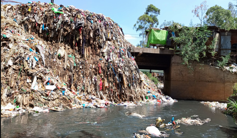 The current state of the polluted Nairobi River. President William Ruto formed the Nairobi Rivers Commission in 2023 and in March this year launched the Nairobi River Regeneration and Engineering Works
Programme to be implemented at a cost of Sh50 billion.
The current state of the polluted Nairobi River. President William Ruto formed the Nairobi Rivers Commission in 2023 and in March this year launched the Nairobi River Regeneration and Engineering Works
Programme to be implemented at a cost of Sh50 billion.What is the function of the declaration of the Nairobi River corridor as a Special Planning Area (SPA)?
The SPA is the legal and planning framework that will tie everything together. It enables structured citizen engagement, harmonises different laws and planning guidelines, and ensures that future developments are sensitive to environmental and community needs.
There’s a misconception that the SPA is about demolishing people's properties. That’s not true. The SPA defines a 60-metre-wide planning corridor (30 metres of which is the riparian zone). We are engaging with communities, recognising historical approvals and land titles while planning for current and future challenges like flooding and climate change.
Residents’ associations, such as KARA, have already begun participating, and we’re expanding consultations upstream and downstream.
What kind of win-win situation do you envision?
First, protecting the rivers protects public health. Contaminated river water
affects farms downstream that supply Nairobi’s food. Protecting the river
safeguards our food system and reduces health risks like waterborne diseases
and even cancers.
Second, landowners will benefit. Protecting riparian corridors doesn’t mean they lose ownership; it simply guides appropriate land use. By bringing in sewers and infrastructure, the value of adjacent land will actually rise, enabling more dense and sustainable developments.
Third, creating predictability through the SPA process ensures that property owners, developers, and planners know exactly what can be done and where – removing today’s confusion and conflicting regulations.
To be very clear, do we expect any displacements and demolitions?
If necessary, any displacement will be done legally and
compassionately, with resettlement into social housing or lawful compensation.
The earlier clearances in 2024 responded to immediate flood risks; future
interventions will follow a structured engagement process.
It’s important to clarify that the regeneration project aims to benefit the public, not displace communities unfairly. There is no forced eviction policy; it’s about structured resettlement to safer, healthier living environments.
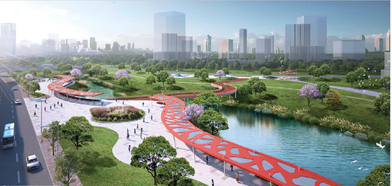 An image of how the revamped Nairobi River corridor will look after the revamp, expected to be complete by 2027.
There are many laws that guide developments in these areas. There is the Water Act. There is a Physical Planning Act. There is the Environmental Management and Co-ordination Act (Emca). Some of these the laws are conflicting. How do you plan to address that
The Physical Planning Regulations harmonise existing laws, setting out clear
standards for planning near rivers, wetlands, and riparian zones. The SPA will
go a step further by applying science (flood
maps, infrastructure plans, environmental studies) to guide development.
Currently, enforcement is fragmented between Water
Resource Authority, NEMA, and others. Once the SPA is approved as a local
physical development plan, it becomes the binding framework that guides landowners
and authorities consistently.
Do members of the public and civil society have opportunities to appeal some of the decisions that will be made?
Yes. The Physical Planning Act provides for appeals through Nairobi County
mechanisms and up to the Environment and Land Court. This is a public interest
project, touching on land rights, public health, environmental justice, and
sustainable development.
We welcome civil society participation to ensure
that all voices, not just property owners, but
downstream farmers, public health advocates, and community groups, are heard.
What is the timeline for completing the development plan?
The law provides a two-year window. That conveniently matches the timeline for
completing trunk sewers, flood mitigation, and early regeneration works.
By 2027, we aim to have in place upgraded sewer
systems, flood defences, upgraded riverfronts from Museum Hill to First Avenue in
Eastleigh, and the SPA legally adopted to
guide future developments and investments sustainably.
So simply put, what should people expect in the next two years?
By 2027, we expect: 60km of trunk sewers completed; decentralised sewage plants operational; flood-prone river sections deepened, widened, and
embanked; core sector regeneration (Museum
Hill to First Avenue) completed with walkways and market integration; affordable and social housing units to accommodate
those resettled; and SPA
finalised and operational to guide
development.
We also aim to expand this regeneration to other
rivers like Mathare and Ngong. Addressing Nairobi Dam, which is now basically a large septic tank due to sewage
from Kibera, is a critical next step.
Has the project already employed young people?
Yes. After the floods of 2024, the Climate Works Programme employed 20,000 to 25,000 youth to clear rivers, remove debris, and
prepare for full-scale regeneration. That project was a precursor.
Now, the main Nairobi River regeneration project
will absorb these youth and create opportunities for an additional 20,000,
focusing on labour-intensive work.
Young people will also be trained through TVET programmes linked to the social
housing projects. They work three weeks and spend one week in training,
upskilling for long-term employment.
The goal is not only to clean rivers but to build
capacity and ownership among communities, ensuring long-term sustainability.


![[PHOTOS] Guardian Angel bus catches fire in Kikuyu](/_next/image?url=https%3A%2F%2Fcdn.radioafrica.digital%2Fimage%2F2025%2F04%2F58287f0a-f201-4a78-87f0-6f147ad8ba8a.jpg&w=3840&q=100)


