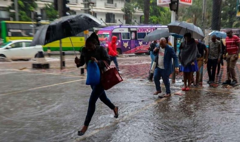


Half of the country will experience a blend of chilly weather and light rains, at least for the next five days, the Kenya Meteorological Department has predicted.
The forecast, ending Monday next week, indicates grey skies and frosty breeze sweeping from the western Kenya border to central Kenya, including most parts of the Rift Valley.
“Rainfall is expected to continue over a few areas in the highlands East and West of the Rift Valley, the Central Rift Valley and North-western Kenya,” Kennedy Thiong’o, deputy director of the met department said.
West of Rift Valley covers Siaya, Kisumu, Homa Bay, Migori, Kisii, Nyamira, Trans Nzoia, Baringo, Uasin Gishu, Elgeyo-Marakwet, Nandi, Nakuru, Narok, Kericho, Bomet, Kakamega, Vihiga, Bungoma, Busia and West Pokot counties.
The highlands east of the Rift Valley includes Nairobi, Nyandarua, Laikipia, Nyeri, Kirinyaga, Murang'a, Kiambu, Meru, Embu and Tharaka.
Night temperatures will drop to as low as eight degrees.
“Intermittent cool and cloudy conditions are expected over some parts of the highlands east and west of the Rift Valley, the south-eastern lowlands and the Rift Valley,” Thiong’o said.
North-eastern (Marsabit, Mandera, Wajir, Garissa and Isiolo counties) will be hot day and night, with daytime temperatures hitting 37 degrees.
Separately, weather networks around the world announced the anticipated La Niña will delay for a few more months, to begin toward the year end.
La Niña is often characterised by drier-than-usual weather in Kenya.
The US government forecaster said the current neutral phase between La Niña and El Niño weather patterns is expected to continue for several months.
“La Niña [is] favoured to emerge during August-October (70 per cent chance) and persist into the Northern Hemisphere winter 2024-25 (79 per cent chance during November-January),” the Climate Prediction Centre said on Tuesday in its monthly forecast.
El Niño is often (but not always) followed by La Niña the following year, particularly if the former was strong.
Kenya last experienced a La Niña from 2020–23, a rare three-year phenomenon, which led to debilitating drought.
Last month, the World Meteorological Organization indicated La Niña may develop from August.
But WMO cautioned it may not necessarily lead to drought in East Africa.
The effects of each La Niña vary depending on the intensity, duration, time of year and the interaction with other modes of climate variability.
East Africa’s weather is influenced by the Indian Ocean Dipole, which can cause heavy rains or dry spells.
"La Niña conditions generally follow strong El Niño events and this is in line with recent model predictions, although high uncertainty remains regarding its strength or duration,” said Ko Barrett, the WMO deputy secretary.
The phenomenon refers to the large-scale cooling of the ocean surface temperatures in the central and eastern equatorial Pacific Ocean.
The Kenya Meteorological Department has not yet commented on the WMO update, which is made by synthesising weather models from different regions.