
El Niño is a natural climate pattern that starts far away in the Pacific Ocean, but its effects are strongly felt in Kenya. It happens when ocean waters in the central and eastern Pacific become warmer than usual, changing wind and rainfall patterns across the world.
These changes can lead to heavy rains and floods in some places, while others experience drought and heat.
The World Meteorological Organisation (WMO) says El Niño conditions are now developing again. The agency warns there is an 80 per cent chance that the phenomenon will form between June and August 2026, with a high likelihood of continuing into November.
The WMO says the warming of ocean waters is already underway and could drive more extreme weather globally.
The Intergovernmental Authority on Development (IGAD), through its climate centre ICPAC, explains that El Niño affects rainfall differently depending on the season in Kenya and the wider region.
According to ICPAC, during the June to September season, El Niño is known to cause depressed seasonal rainfall in parts of the region. This means some areas may receive less rain than usual, increasing the risk of dry conditions.
However, ICPAC also notes that during the October to December season, El Niño is associated with enhanced rainfall over equatorial countries such as Kenya, Somalia, southern Ethiopia and Uganda. In this period, Kenya often experiences heavy rains that can lead to flooding.
How El Niño affects Kenya
In Kenya, El Niño is most commonly linked to heavy rainfall during the October to December short rains season. But the impact is not always the same because other climate systems, especially the Indian Ocean Dipole (IOD), also influence weather patterns.
When El Niño occurs together with a positive IOD, Kenya often experiences stronger-than-normal rainfall.
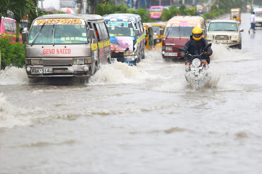
Recent events show how powerful this combination can be. In 2023, El Niño and a positive IOD brought unusually heavy rains across Kenya.
While some areas benefited from improved water supply after drought, many others suffered floods, displacement of families, damaged roads, and destroyed homes.
In contrast, the 2015 El Niño contributed to reduced rainfall in some seasons, worsening drought conditions in parts of the country and leading to food shortages.
The IGAD Climate Prediction and Applications Centre (ICPAC) issued several seasonal outlooks showing how rainfall patterns continue to vary across Kenya.
For March to May 2025, northern and eastern Kenya were expected to receive below-normal rainfall, while parts of western Kenya had a chance of wetter conditions.
For June to September 2025, western Kenya had a higher likelihood of above-normal rainfall, while coastal areas were expected to receive less rain than usual.
Kenya has experienced the impacts of El Niño-related rainfall in recent years. In 2024, heavy rains linked to El Niño and a positive Indian Ocean Dipole led to flooding in several parts of the country.
The Kenya Red Cross Society reported that it responded quickly to assist affected communities, including helping displaced families in camps and supporting emergency rescue operations.
As floodwaters rose, roads were cut off, homes were destroyed, and many people were forced to leave their homes.
Recovery efforts later shifted to rebuilding damaged infrastructure and helping communities return to normal life.
A recent analysis published by the University of Colorado said this El Niño is only likely to be the fifth strongest since 1982.
“Since 1982, when satellite measurements of ocean temperature began, there have been at least four very strong El Niño events: 1982–83, 1997–98, 2015–16 and 2023–24. Based on current forecasts, if an El Niño develops this year, it will be the fifth strongest since 1982,” the analysis said.
Kenya has suffered severe damage during previous El Niño events.
The WMO says the current warming of Pacific Ocean waters is a clear sign that El Niño conditions are strengthening. The agency warns that this pattern is linked to rising global temperatures and more frequent extreme weather events around the world.
“Warm ocean waters are fueling the development of El Niño,” the WMO said.
WMO said many regions are expected to experience
above-average temperatures between June and August.
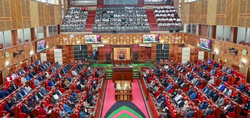
Leaders in the country have called on the government to work on a plan to mitigate the looming floods from El Nino.
Narok Senator Ledama Ole Kina urged counties to prioritise disaster preparedness as the World Meteorological Organization forecasts the return of El Niño conditions that could trigger extreme weather and flooding.
The Narok Senator said counties risk severe human and economic losses if they fail to prepare for the anticipated weather phenomenon.
He called on governors to shift their attention from politics and focus on emergency planning, citing recent flooding incidents in Nairobi that have resulted in deaths, destruction of property and displacement of residents.
“Listen, this is very serious, and you must act now or you will suffer the consequences of inaction. The coming El Niño is not a warning; it is a direct threat to lives, infrastructure, and entire local economies,” Ledama said.
“Governors, stop political campaigns and focus immediately on disaster preparedness. We have already seen the danger: in Nairobi County, floods have killed residents, destroyed homes, and stranded families without warning.”
According to the senator, failure to strengthen vulnerable infrastructure could have devastating consequences for the local economy, particularly tourism, which is a major source of revenue and employment in Narok.