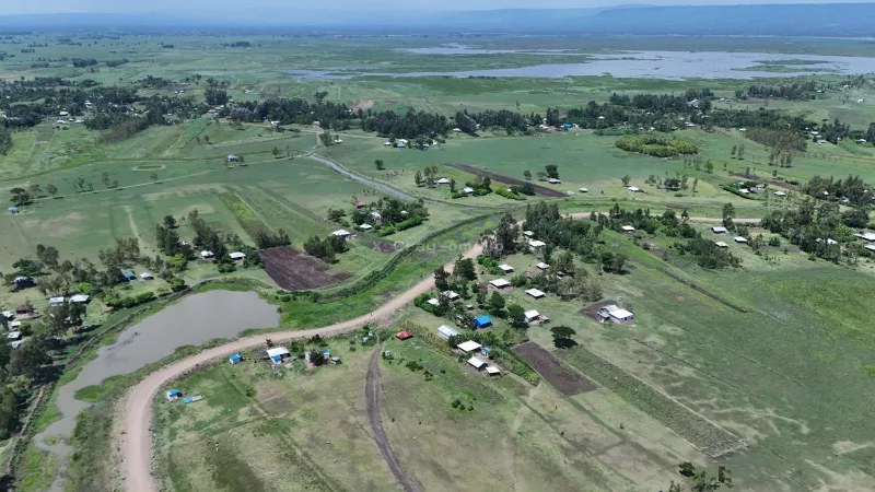
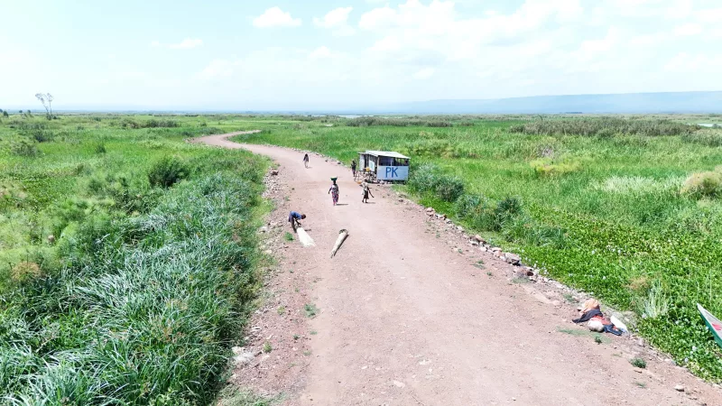
 An aerial view of Kano plains in Nyando/COURTESY
For decades, the arrival of the rainy season brought fear rather than relief to thousands of families living on the flood-prone Kano Plains in Kisumu County.
Whenever River Nyando overflowed its banks or the waters of Lake Victoria backed up into surrounding villages, homes disappeared beneath muddy water, crops were destroyed and families fled to higher ground, often spending weeks or even months in makeshift camps.
The desperate plea of "Sirikali saidia" became a familiar cry from residents who watched years of hard work washed away by floods that returned with predictable regularity.
Today, that cry is slowly being replaced by optimism as the government implements a major flood mitigation project designed to offer a permanent solution to one of western Kenya's most persistent natural disasters.
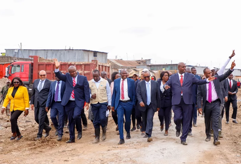
At the centre of the intervention is the West Kano–Kanyagwal Flood Control Project in Kadibo Sub-county, being implemented by the National Water Harvesting and Storage Authority (NWHSA).
"For years, families in Kano have lived with the fear of losing their homes, farms and livelihoods whenever the rains came. This project is about giving them lasting protection and restoring their dignity," officials implementing the project said.
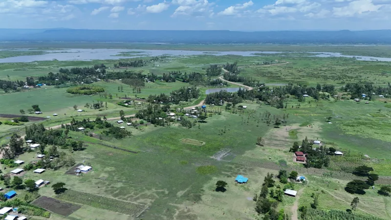 An aerial view of Kano plains in Nyando/COURTESY
The ambitious project seeks to reclaim nearly 7,000 hectares of land that has for years remained vulnerable to seasonal flooding, restoring livelihoods while protecting critical infrastructure and boosting agricultural productivity.
The project includes the construction of a 3.5-kilometre flood protection dyke, rehabilitation of drainage channels, installation and upgrading of high-capacity pumping systems and environmental restoration through extensive tree planting and grassing to stabilise the landscape and reduce soil erosion.
A community footbridge has also been constructed to ensure residents can continue accessing schools, markets, health facilities and other essential services even during periods of heavy rainfall.
Officials say the project is already transforming the lives of hundreds of households by protecting the 2,230-acre West Kano Irrigation Scheme, one of the region's key food production areas.
Nearly 1,000 farmers who have repeatedly suffered crop losses due to flooding are expected to benefit from improved flood protection, allowing them to cultivate their land with greater confidence and increase food production.
"By protecting nearly 7,000 hectares of land and the West Kano Irrigation Scheme, we are securing food production, improving livelihoods and enabling families to invest in their future without the constant threat of floods," the officials said.
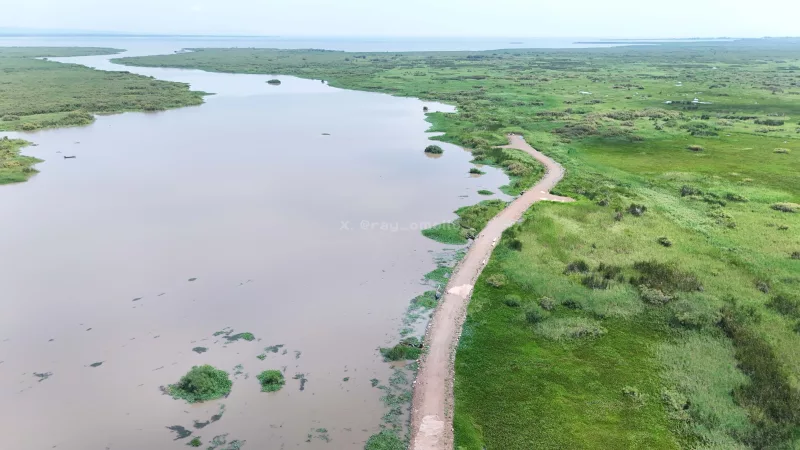 River Nyando/COURTESY
The intervention is also enabling families that were previously displaced by floods to return home and invest in permanent housing after years of relying on temporary shelters and emergency relief.
Communities in Kanduru, Kajowi, Wachiegwe and Karagwel villages are among those expected to benefit from the project, with schools, health centres, roads, markets and places of worship now better protected against flood damage.
Beyond protecting homes and farms, the project is strategically linked to broader development efforts within the Lake Victoria Basin.
It complements the upstream Lake Basin Development Authority (LBDA) dyke system, creating an integrated flood management network while protecting important public investments such as the Kabonyo Kanyagwal Fisheries Centre, a key facility supporting the region's blue economy.
The government says the project reflects a shift from emergency disaster response to long-term climate resilience by investing in infrastructure capable of withstanding increasingly frequent extreme weather events.
Officials note that flood control infrastructure not only reduces disaster losses but also encourages investment, improves agricultural productivity and enhances economic opportunities for communities that have historically lived under constant threat of displacement.
To ensure the gains are sustained, the State Department for Internal Security and National Administration is working with county leaders, national agencies and local communities to strengthen disaster preparedness and emergency response mechanisms across the flood-prone region.
"Our focus is not only on building flood control infrastructure but also strengthening disaster preparedness and community resilience so that residents are better equipped to cope with future climate-related emergencies," Internal Security Principal Secretary Raymond Omollo said.
The department is also spearheading community awareness campaigns aimed at improving preparedness while building local capacity to respond to climate-related emergencies.
For many residents of the Kano Plains, the project represents far more than engineering works.
It offers the promise of stability after years of uncertainty, giving farmers confidence to plant without fear of losing their harvests, enabling children to attend school uninterrupted and allowing families to rebuild their lives on land they had once feared abandoning forever.
As climate change continues to intensify extreme weather events across the country, the West Kano–Kanyagwal Flood Control Project is emerging as one of Kenya's flagship examples of how strategic infrastructure investment can protect lives, secure livelihoods and build resilience for vulnerable communities.